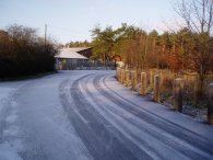
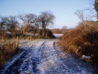
(1) Road nr Cecil Saw Mill
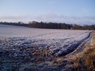
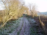
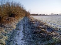
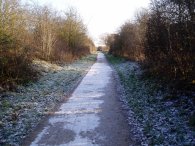
(2) Lea Valley Walk Path
(3) Lea Valley Walk Path
Other Links >>> |
|
LEA VALLEY WALK - STAGE 2
Hatfield - Broxbourne
|
|
|
|
(1) Road nr Cecil Saw Mill |
(2) Lea Valley Walk Path |
(3) Lea Valley Walk Path |
It was a very cold morning but clear and bright with hardly any wind and at Hatfield there was a thin covering of snow on the ground.
For this stage of the walk I followed the route of the Lee Valley walk as shown on my Ordnance Survey map although after walking it I am pretty certain that the first three of four miles of this part of the route has been re-directed.
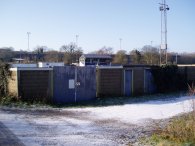
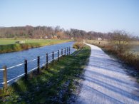
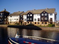
The walk from Hatfield station down the Old Hertford Road to begin the walk at the slip road to the A414 seemed much shorter than when I had walked it at the end of the previous stage and I was soon on my way. A Lea Valley walk marker on the fence pointing the way ahead. On the map the path appears to run alongside the A414 in the grounds of Home Park until cutting through a short stretch of woodland to the Cecil Saw Mill however there was no way I could see to get through the fence. As I reached a bus stop I looked across the road and could clearly see a Lea Valley Walk signpost on the North side of the carriage way so I crossed the road. One sign pointed West past Mill Green rather than the way I had just come, the other East along the A414 which on the North side at least had a footpath to walk along unlike the otherside. I followed the North side of the A414 until I reached the junction with Gipsy Lane. Here there was another Lea Valley Walk signpost that pointed North up the lane however on the map the path was marked as passing the end of the road on the South side. My initial assumption was that the sign had been turned round, not an entirely uncommon occurrence, so I once again crossed over the A414 and headed down the road to the Cecil Saw Mill, photo 1, and rejoined the route of the Lea Valley Walk as marked on the map.
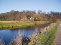
A short stretch of road walking led to a bridleway running between the bottom of some fields and the River Lea. Along this stretch there were the occasional Lea Valley Walk markers nailed to posts. The track was very picturesque in the early morning sunshine with the dusting of snow in the ground, photo's 2 to 5.
 |
 |
 |
(4) Lea Valley Walk Path |
(5) Lea Valley Walk Path |
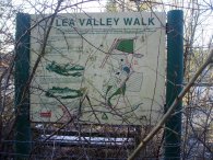
(6) Lea Valley Walk information board, Holwell Court |
After a very short stretch of road walking the path crosses the River Lea at Holwell Bridge and led to more confusion. Just up the road from the bridge was a small kissing gate leading into a field. The gate looked quite new and had the "Lea Valley Walk" carved into it however I also noted a small bit of plastic stuck to it stating something like that it led to a permissive path and permission to use it had been withdrawn. Well something along those lines anyway. However I decided to continue ahead and followed around the side of the field towards the thin stretch of woodland below Holwell Court. Although the path was marked here on the map I could find no clear path through the woodland although there was the hint of one further on through the brambles. I spent some time here wondering if I should continue on, which I did in the end, or turn back. So much for a simple stroll through the countryside!
As I reached then end of the woodland, opposite Holwell Court there was a larger metal sign saying I was on a what was a permissive path for the time being, nothing about it being closed and at least I was in the right place at the end of the woods.
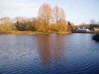
The path then went by the bottom of a lake before turning a corner to go up the right hand side towards Deadfield Lane. Here was the Lea Valley Walk information board shown in photo 6, which was now rather overgrown. It gave a bit of history about the site which had been used for the extraction of sand and aggregate in the 1980's before being reinstated in to farmland. It also said the following which I can make out on the full size version of the photo. "The Lea Valley Walk is a fity mile regional route from the Thames to the source of the River Lea at Luton. The new permissive footpath around Holwell Courrt joins with the exisiting Cole Green Way. This new section of path provides the missing link in the Lea Valley Walk and has kindly been permitted and constructed by Redland Aggregates". There was no date on the sign to say when it was opened.
Once past the lake the path disappeared again and I was forced to walk along the side of a field to reach Deadfield Lane.
 |
 |
 |
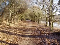
(7) Cole Green Way |
(8) Cole Green Way |
(9) Hertford FC |
The gate at where the end of the path should have been was also completely overgrown. I then followed the path round Deadfield lane to the route of the former Welwyn to Hatfield railway line, also known as the Cole Green Way, which is then followed all the way to Hertford. Where the path joined the former rail line there was a Lea Valley Walk marker pointing North along the trackbed rather than the way I had just come from. This, along with the sign at Gipsy Lane and the general state of the path around Holwell Court is has led me to believe the path has been rerouted.
The smooth track bed made for easy walking, photos 7 and 8, and I was able to walk at a quicker pace than earlier and it did not take that long to reach the outskirts of Hertford. Part of this stretch of walk is shared with the Hertfordshire Chain Walk. As the path reaches Hertford it passes the ground of Hertford FC, photo 9, before going on into the center of the town.
 |
 |
 |
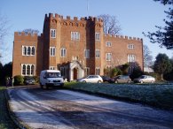
(10) Hertford Castle |
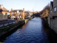
(11) River Lea Navigation, Hertford |
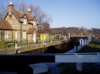
(12) Hertford Lock |
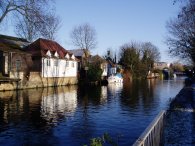
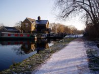
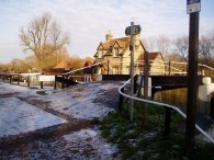
The path passes Hertford Castle, photo 10, before going along Maidenhead Street and Bull Plain to rejoin the River Lea, photo 11, which at this point has become the canal known as the River Lea Navigation. For the remainder of its length the Lea Valley Walk now follows the towpath all the way down to the River Thames.
At the edge of town the first lock, Hertford Lock, photo 12, is passed.
 |
 |
 |
(13) Lea Valley Path nr Hertford |
(14) Gates across the path |
(15) Countryside nr Little Berkhamsted |
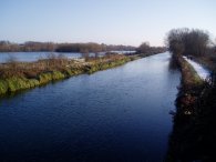
From Hertford Lock the Lea Valley path, photo 13, makes its way towards Ware over a floodplain passing the point where the River Lea is joined from the North by the Rivers Beane and Rib, photo 14.
 |
 |
 |
(16) River Lea, Ware |
(17) River Lea, Ware |
(18) River Lea nr Stanstead Abbots |
The path passes through the center of Ware, photo 16, and continues past a number of newish housing developments, photo 17. This is a feature in a number of area's along the length of the canal, not just around Ware. From Ware the path starts to head in a more southerly direction passing a nature reserve just outside Stanstead Abbots.
 |
 |
 |
(19) Stanstead Lock |
(20) River Lea, nr Stanstead Abbots |
(21) Junction of the Rivers Lea and Stort |
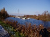
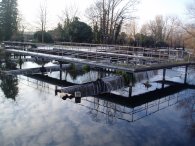
The path passes Stanstead Lock, photo 19, and on past a small marina, photo 20, before heading down besides the RSPB nature reserve at Rye Meads and on to the junction with the River Stort, photo 21. Although pleasant walking besides the canal there is not that much of interest to really see with large parts of the walk looking quite similar.
 |
 |
 |
(22) Fieldes Weir Lock |
(23) Dobbs Weir |
(24) Canal boat, Dobbs Weir Lock |
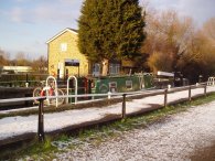
From the junction with the River Stort the path passes Fieldes Weir Lock, photo 22, and heads on to Dobbs Weir, photo 23, a mile or so further on. A little past Dobbs Weir itself is the Dobbs Weir Lock, photo 24, and from their only a short walk to Broxbourne Lido and the path to railway station at Broxbourne.
I was feeling quite tired when I finally reached Broxbourne Station as this was the longest walk I had done for some time. It was also the longest walk I have done in my new leather boots. I had no aches or pains in my feet but my thighs were feeling very tired. There were no trains running from Broxbourne station and in a reversal of my good fortune from the morning the replacement bus to Cheshunt pulled off while I was buying my ticket. There was another bus scheduled in six minutes time although this never turned up. Meanwhile three buses for Hertford and a couple for Roydon came and went but nothing more for Cheshunt. Eventually I got a lift in a cab to Cheshunt station. One of the other people waiting for the Cheshunt bus was a friend of a cabbie at Broxbourne Station. Business was slow as there were no trains stopping at the station so he offered to take his mate, and a couple of us waiting, to the station which was a nice gesture. A train to London pulled into Cheshunt station as I arrived and as it was already running late left shortly afterwards. Unfortunatly we had only gone a little way when we stooped for about 15 or 20 minutes due to "problems with the train in front of us". There was no heating on the train which with the temperature below freezing was extremly cold, I was glad I had all my walking gear to keep warm in and half a flask of tea left. We eventually got to Tottenham Hale about 70 minutes after I had got to Broxbourne Station.
The GPS made this walk 16.1 miles long.
![]() Back to:Walking index page
Back to:Walking index page
| ©2012 Bertuchi.co.uk. Please contact me using the email button on the right if you have any questions or comments regarding the site. Any feedback and additional information about places of interest on the walks is always welcomed. All rights reserved. Please contact me if you want to use any of the images or information from the site. ENJOY YOUR WALKING |
|