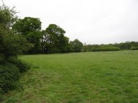
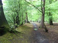
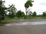
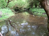
(1) Fields nr Whitwell
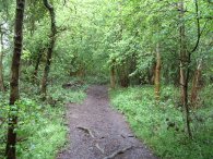
(2) Path by Little Bury Wood
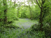
(3) Bluebells, Chalkleys Wood
Other Links >>> |
|
THE HERTFORDSHIRE WAY - DAY 10
Almshoe Bury to Codicote
I did this walk on Monday 7th May. I drove up from Walthamstow and parked in the village of Whitwell. Whitwell is quite a way from where I had finished the last stage of my walk along the Hertfordshire Way although it provided a convenient place to park and the ability to start with a pleasant circular walk.
Whitwell was a very pretty village with a number of attractive houses. Parking in the centre of the village I walked down the main road and turned right down a small road that leads to a bridge over the River Mimram. A little further on this road become an unsurfaced tree lined track.
|
|
|
|
(1) Fields nr Whitwell |
(2) Path by Little Bury Wood |
(3) Bluebells, Chalkleys Wood |
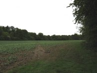
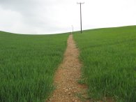
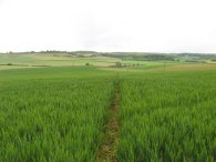
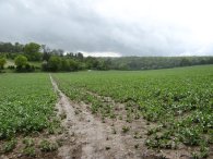
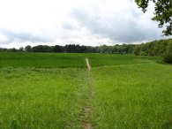
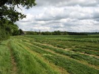
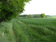
Leaving the track off to the left the route then follows a footpath that runs along the edge of fields, photo 1. The day had started quite grey and it was raining quite heavily when I left Walthamstow but by the time I reached Whitwell this had changed to a light drizzle although the grass in the fields was very wet and soggy. The weather was almost completely calm with only the slightest breeze and it was still very mild for the time of year. I had started the day wearing my fleece but this soon went into my rucksack where it remained for the rest of the day. It was typical that the first time I had been able to go walking for sometime was also the first rainy day for ages. In the Independent I had read that April had been the driest on record with parts of Kent only getting 4% of the normal monthly rainfall. The weather did however give me the opportunity to try out my new Craghoppers waterproof trousers for the first time. The footpath ran down besides the edge of Little Bury Wood, photo 2, and the entered into Chalkleys Wood where there were still the odd patches of bluebells in flower, photo 3. In the first bit of woodland I past very close by a herd of deer sheltering under the trees. The morning rainfall had really brought alive the smells of the leaves and earth in the forest which made a very pleasant change from the air in Walthamstow.
 |
 |
 |
(4) Path nr Stagenhoe Park |
(5) Under the Luton flight path |
(6) Path nr Stagenhoe Park |
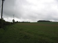
Leaving the woodland the route crosses a small patch of field and then turns left along a gravel track, photo 4, that heads down past a house before again turning left along a tarmac driveway that leads to Stagenhoe House. The area I was walking in was very close to the flight path of Luton Airport and there was an almost constant stream of planes flying quite low overhead, photo 5, disturbing the peace, a sound which would accompany me for much of the day. At the gates to Stagenhoe park the route takes a footpath that runs to the right of the driveway. Reaching a field, photo 6, the route turns right along a footpath that leads to another small stretch of woodland. As ever in Hertfordshire I found that all the footpaths I was walking on were generally very well signposted and I was seldom unsure of the correct right of way, something a few other county councils could learn from.
 |
 |
 |
(7) Path towards Hitch Wood |
(8) Hitch Wood |
(9) Hitch Wood |
Reaching a house the route turns briefly to the left, then right, to take a track beside some woodland before taking a path that runs diagonally over the middle of a field towards another larger patch of woodland, photo 7. Entering Hitch Wood I had to skirt another fallen tree that was blocking the path, photo 8. Progressing through the wood the trees become less dense, photo 9. At the end of the woodland I turned left into Hitchwood Lane which continues on into the grandly named St Albans Highway. A short distance past the road junction the route takes a footpath off to the right. This footpath is signed Little Almshoe 1 ½ miles and is also signed as part of the Chiltern Way extension, a path I would follow for almost all the remainder of the day.
 |
 |
 |
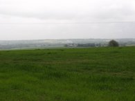
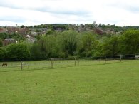
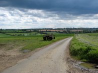
(10) View towards Stevenage |
(11) View towards Almshoe Bury |
(12) Heading towards Chapelfoot |
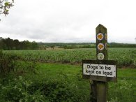
The footpath runs past a grass covered reservoir before turning left to follow the edge of a field. A short distance further on, passing through the hedge the views ahead open up over Stevenage and the surrounding countryside complete with the landmark Lister Hospital, photo 10, as well away on a hill in the distance the farm at Almshoe Bury, photo 11, where I get to rejoin my walk along the Hertfordshire Way.(Not that these can really be made out in the photo's above!). The path then starts heading gently downhill over fields for about a third of a mile to reach a road at a place named on the map as Chapelfoot. Crossing the fields the air was filled with the sound of skylarks chattering away. It had just been raining quite heavily with a number of squally showers passing over but as I made my way down to the road these had stopped and the air was once again still and dry.
 |
 |
 |
(13) Field nr Almshoe Bury |
(14) Almshoe Bury |
(15) View from Almshoe Bury |
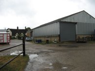
I turned right onto the road to pass the Royal Oak pub. Besides the pub I linked up with the route of the Hertfordshire Way although I still had a short walk uphill over fields on the other side of the road, photo 13, to reach the point where I had ended my last walk at Almshoe Bury. The four miles I had travelled to reach the Royal Oak pub were along some of the nicest stretches of paths that I can remember walking and I was really pleased I had decided to start my walk at Whitwell. When I reached the point I had ended my last walk along the Hertfordshire Way I had walked 4.38 miles. Leaving the farm, photo 14, the Hertfordshire Way takes a path that runs diagonally downhill over fields towards a road. Photo 15 was taken looking back from Almshoe Bury over the area I had just walked. Reaching the road the route then turns right for a short distance to reach the Royal Oak pub where the Hertfordshire Way heads off up to the left which is where I began my walk back towards Whitwell.
 |
 |
 |
(16) Path nr Chapelfoot |
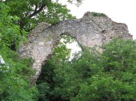
(17) Minsden Chapel |
(18) Field nr Minsden Chapel |
Skirting the side of the pub the Hertfordshire Way heads off to the left along a grassy hedge lined track. This started heading gently uphill alongside a field, photo 16. Stopping for a sandwich, I by chance spotted the ruins of Minsden Chapel, photo 17, hidden amongst trees just off the route of the path. The ruins also provided some shelter from what proved to be the heaviest, and also final, downpour of the day. Continuing along the route makes its way down over a field, photo 18, to a road then takes a broad path running diagonally uphill on the other side. Heading uphill the route joined the end of a lane for a very short distance before the Hertfordshire Way takes a footpath off to the right that runs past gardens into a field from where the Lister Hospital could once again be seen away to the left. The route follows a broad farm track besides the field. From the heavy downpour within about five or ten minutes the sun was starting to break through the clouds and I soon began to dry off. My trousers were fully waterproof but it was too warm to wear my jacket so my T shirt had got quite wet in the rain although it did not take too long to dry off. With the clearing skies the wind also began to pick up and the remainder of the day was quite breezy in marked contrast to the still start of the day.
 |
 |
 |
(19) Heading towards St Paul's Walden |
(20) All Saints Church, St Paul's Walden |
(21) Path towards St Paul's Walden Bury |
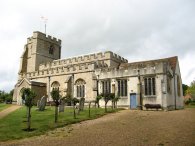
At the end of the field the Hertfordshire Way takes a tree lined footpath off to the right which runs downhill to eventually reach a minor road. Crossing over the road the footpath heads over a low stile and into another field. The route heads across the field making for a patch of pine trees on the near horizon, photo 19. The route heads besides the trees over a path of meadow. Passing through a patch of trees the route reaches another road where it turns left passing the entrance to Stagenhoe Park which is now a Sue Ryder home. Route heads down the road to a footpath on the right signposts St Paul's Walden 410 yards, the route is still following the Chiltern way extension and was once again the route is directly under the incoming flight path of Luton Airport. Reaching St Paul's Walden the route turns left onto the road and heads a past a large white house before turning right and passing through the churchyard of All Saints Church, photo 20, the church where the late Queen Mother was christened. The Hertfordshire Way then continues along a gravely tree lined track running straight ahead, photo 21, towards St Paul's Walden Bury.
 |
 |
 |
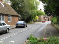
(22) Approaching Whitwell |
(23) Whitwell |
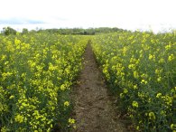
(24) Fields nr Whitwell |
Eventually the track reaches a house and becomes a tarmac track, the route continuing ahead passing the buildings of The Bury away on the right. At a sharp right hand bend in the track the route continues ahead through an old metal gate into a grassy field from where the town of Whitwell can be seen ahead in the distance, photo 22. The route heads downhill between paddocks that were being grazed by horses to cross a bridge over the River Mimram and enters Whitwell. Passing my car in the process I had done 7.87 miles so far in what had been a very pleasant circular walk which would have been worth doing in it's own right. From Whitwell, photo 23, the route turns right onto the road for a short distance before taking a footpath that heads up between houses off to the left. Reaching a field the route turns left then right to head across a number of grassy fields with pleasant views. I then headed over two very large fields filled with Oilseed Rape, photo 24. These were well on the way to finishing flowering and the green seed pods were starting to develop on the plants, although I was still quite covered in the heavy yellow pollen by the time I left the fields.
 |
 |
 |
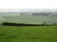
(25) Fields nr Hoo Park |
(26) Fields nr Hoo Park |
(27) Watercress Beds |
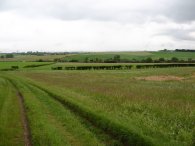
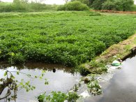
Reaching a hedge the route turns left alongside a huge open field, photo 25. Passing a barn the route crosses a driveway and continues over a stile into another field with a small cricket pitch fenced off to the left. Passing over several more fields, photo 26, the route reaches a driveway and heads to the right over an ornamental bridge that once spanned a now dried up pond. At a road the Hertfordshire Way turns right and takes a track that runs off immediately to the right. The track follows the course of the River Mimram as it makes its way down to Rye House cottages. Passing the cottages the route bears along the track to the left to head down to a road where the route turns to the right. A short distance down the road the path passes some watercress beds on the right, photo 27, before taking a footpath off to the left signposted "Codicote Bottom ¾ mile".
 |
 |
 |
(28) Footpath to Codicote Bottom |
(29) River Mimram |
(30) View over Kimpton |
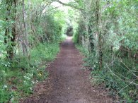
I started walking down the track for a short distance before stopping my walk for the day at a point reasonably convenient for re-joining the route when I walk the next stage, photo 28. When I stopped and turned round I done exactly 10.7 miles for the day which made it 6.32 Hertfordshire Way miles. There was no obvious way to make a convenient circular walk back to Whitwell so I re-traced my steps back. The path from Codicote Bottom runs near to the River Mimram and on the way back I detoured briefly to take photo 29. On the way I spotted a small Muntjac deer crossing the cricket ground near the Hoo. Photo 30 was taken looking South over Kimpton from near Hoo Park Cottages. There was a fair on in Kimpton and I could hear the sound of music rising up from the village below.
When I got back to the car in Whitwell I had walked a total distance for the day of 13.7 miles.
Not many of the miles were along the Hertforshire Way but it had been a very pleasant days walking and I am making steady progress, moving onto Ordnance Survey Landranger Map 182.
![]() Back to:Walk index page
Back to:Walk index page
| ©2012 Bertuchi.co.uk. Please contact me using the email button on the right if you have any questions or comments regarding the site. Any feedback and additional information about places of interest on the walks is always welcomed. All rights reserved. Please contact me if you want to use any of the images or information from the site. ENJOY YOUR WALKING |
|