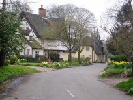
(1) Cottered
(2) Fields nr Cottered
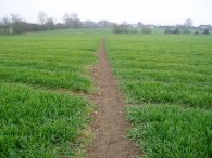
(3) Fields nr Throcking
HERTFORDSHIRE CHAIN WALK - LINKS 13, 14 and 15
Circular from Cottered via Sandon and Therfield
|
|
|
|
(1) Cottered |
(2) Fields nr Cottered |
(3) Fields nr Throcking |
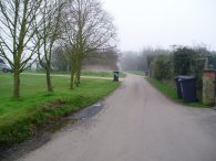
I walked these sections of the Hertfordshire Chain Walk on 15th April 2006. It was a grey gloomy morning more fitting to Winter than Spring and quite chilly for the time of year. I parked in side rod in Cottered which is on the Hertfordshire Chain walk, close to where links 12 and 13 join up, photo 1. The path turns left by the wheelie bin at the left of the road and runs along the edge of a field behind house to cross the A507, photo 2, although this is obscured by the mist.
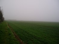
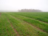
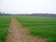
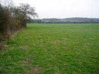
The path then makes it way across fields, photo 3, in a rather roundabout way crossing one field only to then turn around and cross back the other way to eventually join the Throcking Road, just before Whytegates Farm. I guess the route must be following established rights of way but it would have made more sense to just go round the top of the field boundary. With the recent rain and the damp weather the fields were very muddy and my boots and trousers were soon caked in mud.
 |
 |
 |
(4) View towards Broadfield Hall |
(5) Looking towards Bush Wood |
(6) Field nr Little Manor Farm |
From the Throcking Road the path turns up past Coles Green Farm and heads across fields in the direction of Broadfield Hall which can just about be made out through the mist in photo 4. On the way the path passes under a couple of rows of Electricity pylons. For probably the first time on the entire walk I needed to concentrate to follow the route of the path as the paths across the fields in this area were not always evident on the ground and in a number of places field boundaries that were marked on the map have been dug up to make larger fields. Having said that, on all occasions I was able to spot footpath markers in the distance to give me something to aim for as I crossed the fields but it was not quite as straightforward as following a clearly defined path. As the crops grow bigger I guess the route of the paths will become easier to see or the farmer may spray the path. Once past the first set of electricity pylons the quality of paths improved and remained better for the rest of the day. It really was only the first couple of miles that were a bit difficult. From Broadfield Hall the path heads past Bush Wood, photo 5 before turning north by Park wood to head up to Little Manor Farm where the next link of the chain walk is joined. The path heads past the farm and across various fields, photo 6, for three quarters of a mile to join a road to the East of Southern Green. On this stretch I saw a considerable number of yellowhammers flying about in the hedges, the first I had spotted for some years.
 |
 |
 |
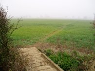
(7) Another trackless field |
(8) Walk signposts |
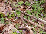
(9) Violets |
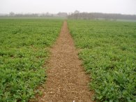
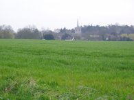
The route of the Hertfordhire Chain Walk heads up the road towards Offley Green, past the gardens of a small group of houses at Friars Grange and on across fields towards Roe Green. While there was no clear path across the final field, photo 7, fortunatly the soil was not to damp and did not stick to my boots to any great extent. Crossing the field I could see numerous deer tracks in the soil. At Roe Green the Hertfordshire Chain Walk links up with the routes of both the Hertfordshire Way and the Icknield Way, photo 8. For the next couple of miles the paths keep bumping into each other as they both take slighlty different routes in the same general direction. Passing through Sandon the Hertfordshire Chain Walk meets up with the next chain of the walk, near Sandon Church. The route of the path follows main road out of the village towards Notley Green where the path turns left up a road for a short distance and then left again along Notley Lane. There were a few spring flowers out in the lane including a small group of violets, photo 9.
 |
 |
 |
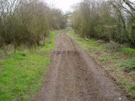
(10) Notley Lane |
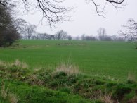
(12) Approaching Therfield |
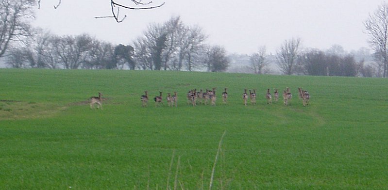
As I approached Philpotts Wood a hare appeared briefly on the path in front of me, stopping for a quick look before running off into the fields. The path leaves Notley Lane, photo 9, and cuts across fields to join another green lane, Kelshall Lane. Between the two lanes I spotted a couple of groups of deer. There were 27 in biggest group most of which can be seen running off in photo 11, alongside the route of the path. (Click green text to see a larger version). From Kelshall Lane the path goes onto Ducks Green before turning across fields to Therfield, photo 12.
 |
 |
 |
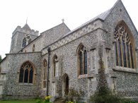
(14) Church of St Mary Virgin, Therfield |
(15) Path towards Kelshall |
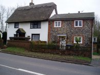
Therfield was a very attractive little village, photo 13, with numerous interesting buildings. The path turns left down a road opposite the pub that leads to the Church of St Mary Virgin, photo 14. Passing through the churchyard the path heads across more fields towards the village of Kelshall, photo 15.
 |
 |
 |
(16) Fields nr Kelshall |
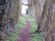
(17) Path to Sandon Church |
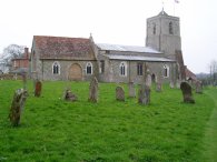
(18) All Saints Church, Sandon |
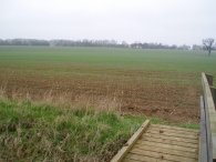
At the road the path turns left for a short distance before taking a footpath off to the right that heads in the direction of the church. Just before the church is reached the path heads off to the left again through a complicated series of small fenced off fields. Eventually a larger field is reached that takes the path to a road by Woodcotes Farm. This is one of the highest sections of the walk and there were reasonable views across to the North West, photo 16, although these did not really come out in the photo due to the weather. The path then makes it way along the road back towards Sandon, turning on to a narrow tree lined path between fields, photo 17, that leads to Sandon Church. Going along the path a cross in the graveyard could be seen on the horizon at the end of the path. The path passes All Saints Church in Sandon, photo 18, an unusual church that almost seems like two buildings stuck together, and heads back to the main road past the village green. The village sign featured a white goose and sure enough one was sitting on the grass close to the sign. This completed what I have currently made the 15th link of the chain walk.
 |
 |
 |
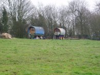
(19) Caravans, Sandon |
(20) Field nr Mill End |
(21) View towards Little Manor Farm |
 |
 |
 |
(22) Road nr Broadfield Hall |
(23) View towards Cottered |
(24) Cottered |
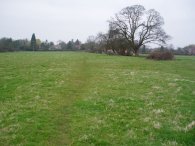
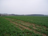
The GPS made this walk 15.3 miles long. The walk was through a very rural area mainly along paths running across farmland as seen in the rather similar photos' above. There was only one significant stretch of road walking just past Sandon heading towards Therfield. Once again, generally easy walking over pleasant countryside and still under an hours drive from London.
![]() Back to:Walking index page
Back to:Walking index page
| ©2008 Bertuchi.co.uk. Please contact me if you have any questions or comments regarding the site. Additional information about places of interest on the walks is always welcomed. All rights reserved. Please contact me if you want to use any of the images or information from the site. Thank you. |
|