HERTFORDSHIRE CHAIN WALK - LINKS 7 & 8
Figure of eight from Watton at Stone
 |
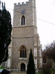
(1) St Andrew and St Mary church, Watton at Stone |
I walked the 7th and 8th links of the Hertfordshire Chain Walk on 26th February 2006. Both links were quite short and I also went on to walk the next link which is described on the following page as well.
I parked outside the George and Dragon pub in the centre of Watton at Stone and after a short walk along the High Street set off along the footpath that heads up towards the impressive church. On the way this runs past some playing fields where a Sunday league football match was just about to commence as I was going past.
 |
 |
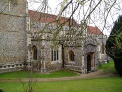
(2) St Andrew and St Mary church, Watton at Stone |
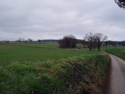
(3) Perrywood Lane, Wattton at Stone |
From the church of St Andrew and St Mary, photo 2, the route of the chain walk heads up Perrywood Lane, photo 3, towards Perrywood Farm and on into Bramfield woods.
 |
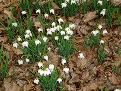 |
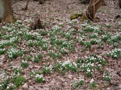
(4) Snowdrops, Bramfield Woods |
(5) Snowdrops, Bramfield Woods |
In a small patch of woodland besides Perrywood Lane there was a large group of snowdrops under the trees, photo's 4 and 5.
 |
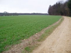 |
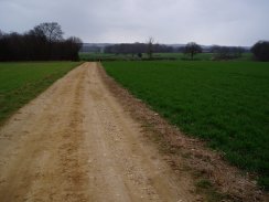
(6) Farmland nr Bramfield Woods |
(7) Farmland nr Bramfield Woods |
It was a cold grey day with a fairly strong north easterly wind and as I approached the main part of Bramfield woods it started snowing slightly although this did not last for long.
The early stages of the walk were accompanied by the sound of gunfire and I guess something like clay pigeon shooting was taking place somewhere in the vicinity, it was fairly constant. From the path towards Bramfield woods there were very good views across the gently rolling countryside, photo's 6 and 7, although these would have been more enjoyable if the weather had been a bit better.
 |
 |
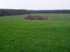
(8) Farmland nr Bramfield Woods |
(9) Tewin Hill |
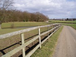
Just before reaching the main part of Bramfield Woods and linking up with the 6th link of the chain walk the path, still on Perrywood Lane, although it had now become an earth track rather than a tarmac road, passed an odd circular bit of woodland in a field, photo 8. It was tempting to go and explore to see if I could determine why it was there but it was a bit off the public path. An old quarry or a bomb site perhaps?
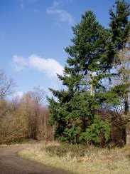
While walking through Bramfield Woods the sun came out for a short time which made it seem almost like a different day. One of the advantages of a strong wind is that the weather blows over quickly however it also meant the weather clouded over quite quickly again too. Photo 10, taken while the sun was out, marks one of the joins between the sixth and seventh links of the Hertfordshire chain walk.
 |
(10) Bramfield Woods |
Through the top end of Bramfield woods by Brights Hill, there was a little confusion over the exact route with the path passing past a sign saying no public access although a few yards further on, tied to a stake, there was a council print of an ordnance survey map showing the route of the bridleway that the path follows. The path then makes its way out of Bramfields Woods towards Great Gobions Farm before turning towards the North and starting to head back to Watton at Stone. Up to this point I had been walking rather slowly, the GPS showed only 2.7 miles an hour, so I resolved to stop looking around quite so much and to up my pace even though for this part of the walk the wind was now blowing directly in to my face. The path makes its way back to Perrywood Lane where the seventh and eight links of the walk crosses over and makes its way past Watkin's Hall Farm where photo 9 was taken before the final stretch down to a lane and into the footpaths of Watton at Stone.
The GPS made this stage of the walk 5.38 miles long.
![]() Back to:Walking index page
Back to:Walking index page