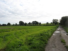
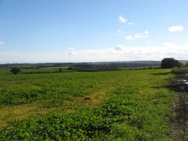
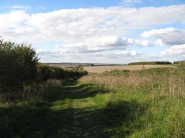
(1) The start of stage 11
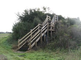
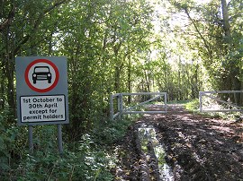
(2) Steps up to Fleam Dyke
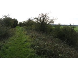
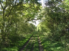
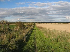
(3) Fleam Dyke
Other Links >>> |
|
THE HARCAMLOW WAY - PART 11
Fulbourn to Balsham
I did this walk on Sunday 31st October 2010.
|
|
|
|
(1) The start of stage 11 |
(2) Steps up to Fleam Dyke |
(3) Fleam Dyke |
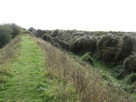
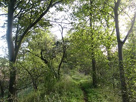
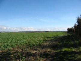
From my parking spot in Stonebridge Lane I only had a brief walk along the track to resume my walk along the Harcamlow Way from where I had finished stage 10 back in early September, photo 1. The route heads along a farm track that is followed round to the left as it runs between fields. Where the track bends to the right the route joins a field edge path on the left that leads up to an unexpected set of wooden steps that heads up to the top of Fleam Dyke, photo 2. The bank and ditch of Fleam Dyke runs for almost four miles between Fulbourn and Balsham. The dyke was built over a period of 150 years between the late 5th century and early 7th century and was probably built by the East Anglian Saxons to control the Icknield Way, the ancient routeway to East Anglia from the west. The dyke still looks an impressive structure today and must have been an outstanding feature in the context of the time it was built. The path then heads across the top of the dyke which cuts a straight route across the Cambridgeshire countryside. Because of this navigation was for once straight forward and this stage of the route was also being shared with the way-marked Fleam Dyke and Roman Road path so little chance of getting lost. Much of the path along top of the dyke is lined with trees and shrubs, photo 3 that limit the views across the surrounding countryside although there were the occasional more open areas, photo 4.
 |
 |
 |
(4) Fleam Dyke |
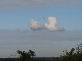
(5) Crouching dog cloud? |
(6) Mutlow Hill |
While I was walking along the dyke I spotted a cloud that looked to me, like a crouching dog, photo 5, although perhaps it was just my imagination! It certainly stood out from the other much higher cloud about although the photo does not do it justice. The path passes by the Fleam pumping station and a short while later the path heads down and up at a point where a long disused railway had once cut through the dyke. Just before the A11 dual carriageway is reached the dyke heads by an old bronze age barrow at Mutlow Hill, photo 6. Just past the barrow was the spot where the Icknield Way passes through the dyke which was the only gap in the structure.
 |
 |
 |
(7) Fleam Dyke from the A11 footbridge |
(8) Fleam Dyke nr Dungate Farm |
(9) Path at the end of Fleam Dyke |
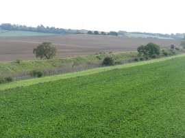
A metal footbridge carries the route high over the main road where the route joins a more open section of the dyke, photo 7, however the trees and shrubs soon start encroaching alongside the path and past Dungate Farm the path becomes much narrower and more enclosed, photo 8. Eventually the dyke peters out and the route joins a footpath running alongside the edge of a large open field. The dyke had been climbing gently uphill and the path was now running along the top of a hill with good views over the surrounding countryside, photo 9.
 |
 |
 |
(10) Byway approaching Balsham |
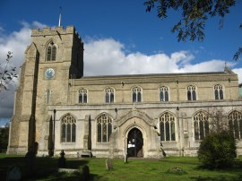
(11) Holy Trinity Church, Balsham |
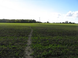
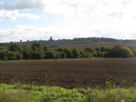
(12) Fields nr Balsham |
Reaching a junction of paths the Harcamlow Way heads to the right along a broad hedge lined byway, photo 10. The byway heads gently downhill and the route soon joins a footpath on the left that heads along the bottom edge of another large field. Reaching the end of the field the path heads to the right alongside a playing field before turning to the left to go through a metal gate by a small sports hall. Here the Harcamlow Way heads right alongside a small play area before turning left again into the grounds of Holy Trinty church in the village of Balsham, photo 11. I then joined a path that ran diagonally in front of the church which I followed into School Lane. This is slightly different from the route as marked on my map which shows a path that heads due south from the churchyard towards the High Street although I did not spot this. From School Lane I headed to the right and walked the short distance back up to the High Street where I rejoined the marked route of the path. Crossing the road the Harcamlow Way heads through the car park of the Bell pub before joining a footpath that heads through a small housing estate. Reaching Bartons Close the route heads to the right for a few yards before joining a footpath that heads past the last house and out into open fields, photo 12. Ahead of me across the field I could see a tractor spraying the crop and for the next couple of miles I was accompanied by the smell of the crop spray as this farmer was not alone in spraying his fields.
 |
 |
 |
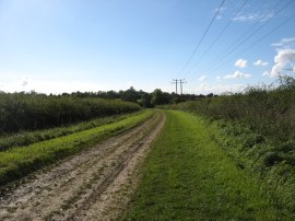
(13) Byway from Balsham |
(14) The end of stage 11 |
(15) Worsted Street |
The route heads across the middle of two fields towards some trees before heading over a high wooden stile into a grassy field. The route bears to the right across this and another small paddock, where a very friendly horse came running over to see me. Leaving this paddock I joined a lane where the path heads south along another byway. This was mainly lined by trees and hedges although there were occasional open spaces giving good views over the countryside I would be walking on my next stage of the walk, photo 13. This byway is followed as it heads down to a junction with another byway which is where I finished this stage of the my walk along the Harcamlow Way having walked a further 7.22 miles along the path, photo 14. The Harcamlow Way heads to the left however I headed to the right to commence my journey back to the car. The byway I was now on follows the course of a roman road and once again no navigation was required as I headed down the path which is followed in a straight line for about 5 miles, the course of the roman road running more or less parallel with the course of the dyke I had been on earlier. At first the path was quite enclosed and muddy but the route became steadily more open and drier underfoot, photo 15.
 |
 |
 |
(16) View towards River Hill |
(17) Heading towards the A11 |
(18) Heading towards the Balsham Road |
The Roman road, the northern part of which is known as Worsted Street, was built to link the roman camps at Godmanchester and Cambridge to Colchester. Nowadays as well as forming part of the Fleam Dyke and Roman Road path the road is also part of the E2 European Route, taking that path into Cambridge. The route crosses over the B1052 Linton Road and then another minor road that leads down to Hildersham. Away to the left there were a number of large open fields and I could see the water tower on River Hill nr Linton, photo 16, which was a prominent mark on the skyline for some time. There were plenty of sloes growing besides the path on this stretch and I stopped to pick a bagful of these which will be used to make sloe gin. The path heads gently up and downhill along its straight course, photo 17, before making its way over a more open stretch of fields to reach the A11. Here the route heads over a narrow road bridge before rejoining the course of the roman road as it runs between fields towards the Gog Magog Hills. My route however followed the Fleam Dyke and Roman Road path and joined a footpath on the right that headed gently downhill between fields, photo 18, for just over one and half miles towards the Balsham Road. At one point the path runs through a narrow band of trees running parallel to the fields before rejoining the field edge path.
Crossing the road I headed up yet another stretch of byway which soon led up to the end of Stonebridge Lane and my parking place. Reaching the car I had walked a total distance of 14.3 miles. This had been a very easy and uneventful walk through the Cambridgeshire countryside. Despite the sunshine and lack of a breeze the air had been much cooler and for the first time since early spring I needed to keep my fleece on all day and still had plenty of water left over at the end of the day.
I have uploaded the route of the walk which can be accessed here Harcamlow Way 11 Route.
If you would like to comment on this walk you can do so here:
![]() Back to:Walk index page
Back to:Walk index page
| ©2012 Bertuchi.co.uk. Please contact me using the email button on the right if you have any questions or comments regarding the site. Any feedback and additional information about places of interest on the walks is always welcomed. All rights reserved. Please contact me if you want to use any of the images or information from the site. ENJOY YOUR WALKING |
|