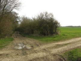
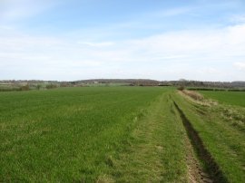
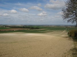
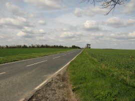
(1) The start of Stage 6
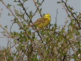
(2) Yellow Hammer
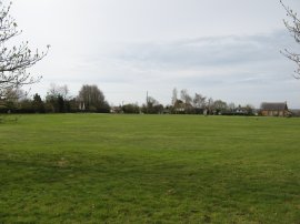
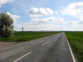
(3) Langley Upper Green
Other Links >>> |
|
THE HARCAMLOW WAY - PART 6
Nr Arkesden to Melbourn
I did this stage of my walk along the Harcamlow Way on 11th April 2010, just one week after I had walked the previous stage. I parked at Langley Upper Green from where it was just under a miles walk over fields back to where I finished up last time on Beards Lane. I had been looking forward to this stage of the walk as not only was I going to go to the county tops of both Essex, and on my return route, Cambridgeshire but I would also finally be leaving the Essex countryside and be heading down into the flatlands of Cambridgeshire, a county I have not really walked in previously apart from a mile or so on the Chain walk several years ago.
|
|
|
|
(1) The start of Stage 6 |
(2) Yellow Hammer |
(3) Langley Upper Green |
The first thing I noticed when I reached the start point, photo 1, was how much the ground had dried out in just a week. When I had reached the byway last week it was very damp and muddy as in the photo on the previous page; now apart from a few small puddles the ground was rock hard. I headed down the byway for a short distance before joining a footpath on the left that ran along a field edge to join a farm track which the route of the Harcamlow Way then follows into Langley Upper Green. In the hedgerows I spotted a number of Long Tailed Tits and also Yellow Hammers, photo 2. Reaching a road the route turns to the left for a short distance before joining a track on the right that runs past some houses at the top of the large green in Langley Upper Green, photo 3.
 |
 |
 |
(4) Oldfield Grove / Essex County Top |
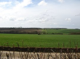
(5) Heading towards Chiswick Hall |
(6) View back to Oldfield Grove |
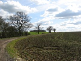
Heading alongside the last house the route joins a narrow hedge lined footpath that heads out into a field. After a short distance the route of the Harcamlow Way turns to the right along a field edge path that heads gently uphill towards the small strip of woodland of Oldfield Grove. At the top of the field the route follows the edge of the wood for a short distance to the left before heading to the right through the narrow band of trees into another field. Somewhere around here is the county top of Essex at 147 mtrs although it was difficult to spot exactly where the highest point actually was, my best guess was the right hand corner of the field in photo 4. From Oldfield Grove the route then follows a long straight path between fields, photo 5, towards the buildings of Chiswick Hall, heading to the left round the buildings and downhill along a driveway to reach the B1039. The route then continues ahead across the road before heading uphill to reach the Holy Trinity Church at Chrishall, a building that had been visible on the horizon from Oldfield Grove which can be seen on the horizon in photo 6 which was taken looking back from the churchyard.
 |
 |
 |
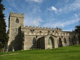
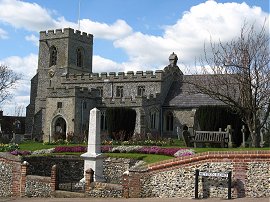
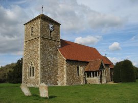
(7) Holy Trinity Church, Chrishall |
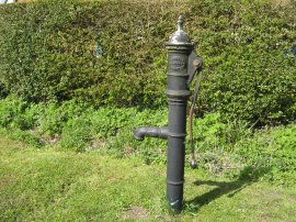
(8) Water Pump, Chrishall |
(9) Deer, nr Chrishall |
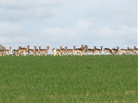
From the church, photo 7, the route heads down to cross Bury Lane to join a footpath that heads up to Chalky Lane. The route then heads between fields, bending round to the left to join Hogs Lane which leads to the High Street in the village of Chrishall, where I passed one of several old water pumps that I saw in the area, photo 8. From the High Street I headed up a track between houses and across a playing field to join another field edge path that leads up to a minor road where the route turns to the right. A short distance after passing another roadside water pump and a small pond the route takes an enclosed footpath that heads gently downhill to reach an open field at which point the Harcamlow Way leaves Essex and enters Cambridgeshire. Ahead of me I could see a large herd of deer slowly crossing the field.
 |
 |
 |
(10) Crop spraying tractor |
(11) Trig Point S4368 |
(12) Heydon |
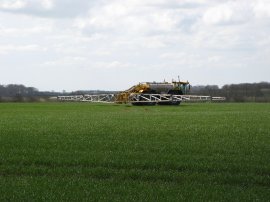
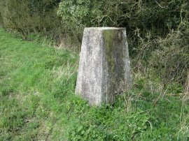
The footpath bends to the left for a short distance before turning to the right to cross over the field where to my left a large tractor was heading up and down spraying the crop, photo 10, and I was glad the wind was blowing in the opposite direction, which, as had been the case on the last two stages of this walk, was blowing quite strongly and once again keeping the temperature down, despite the reasonably bright weather. Having crossed the field the route joins a track with a hedge on the right and as I was walking along the deer I had spotted earlier suddenly all started jumping through the hedge and crossing the track into the field on the left before being scared by the tractor and turning round to head back the way they had come. At the end of the field I made a slight detour to photograph the trig point, photo 11, before heading down to Heydon Lane. Here the route heads to the left along the road, passing besides a pond and along an attractive brick wall lined section of pavement into the centre of the small village of Heydon, photo 12, where the road sign showed it was just 13 miles to Cambridge.
 |
 |
 |
(13) Heading away from Heydon |
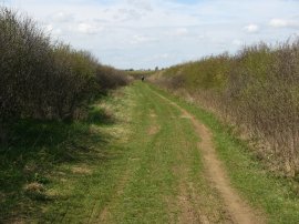
(14) Green Lane by Heydon Golf Course |
(15) New Road |
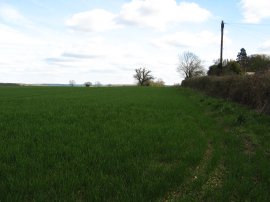
At the junction the route heads to the right along Fowlmere Road before joining a track on the left. Heydon is situated on the crest of a ridge and the track soon start descending downhill between chalky fields into the flat lands of Cambridgeshire, photo 13. Reaching the bottom of the hill I stopped for a short break in the shelter of a hedge before continuing on and turning along a broad hedge lined track, photo 14, that headed to the left, running for a time alongside a golf course. I had originally intended finishing the days walk along the Harcamlow Way at this point, taking a footpath that ran back uphill to Great Chishill however I had made good time and was feeling fit and thus decided to extend my walk a bit further along the path. One thing that I had noticed from the map was that there appeared to be a lot less footpaths than in Essex and I was struggling to find decent circular walks for the next couple of stages. There was also quite a lot of road walking coming up and I decided to try and get as much as this out the way on todays walk, even if it meant a certain amount of retracing my steps. Thus I continued along the track until it reached New Road, photo 15.
 |
 |
 |
(16) The A505 nr Royston |
(17) New Road, Melbourn, and the end point of stage 6 |
(18) Looking back down New Road |
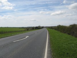
Here I followed the road to the right before turning right onto the B1368 which takes the Harcamlow Way down to join the A505, photo 16. Despite how it looks in the photo, this was a rather busy main road with lots of fast traffic. The road did however have a wide grass verge, which although rather bumpy to walk over meant I was able to keep a decent distance away from the traffic. After about half a mile the route leaves the A505 and heads to the right up New Road, which I assume had once been linked to the New Road I had walked on earlier, towards the village of Melbourn. This was another straight road and whilst not as busy as the A505 much of the traffic was travelling quite fast. The verge was also much narrower and several times I had to stop to ensure the cars passed safely. I walked for just over a mile up this road, almost reaching Melbourn, where I finished my walk along this stage Harcamlow Way. It would have been nice to have reached Melbourn but I was getting ever further from the car and my stopping place did not leave much road walking for next time around. Photo 17 was taking looking towards Melbourn from my finish point and photo 18 looking back the way I had come. At this point I had walked 9.9 miles along the Harcamlow Way for the day. Unfortunately there was now no other option at this point than for me to retrace my steps back down the New Road to the A505.
 |
 |
 |
(19) Footpath heading towards Barley |
(20) Fields nr Barley |
(21) Chishill Windmill |
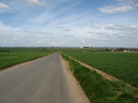
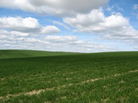
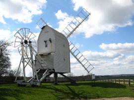
Once back at the A505 I crossed over the road and linked up with the rider route of the Icknield Way. There was the occasional faded way marker although the route did not seem to be much used and at once point was very over grown with no evidence of a path visible. The route also deviated from how it was marked on my Ordnance Survey map, initially running much closer to the A505 than marked and then turning to the left along a field edge rather than heading between open fields as marked on the map. Despite there being no real path I followed the field edge, rather than the marked route and was very pleased to see an Icknield Way sign at the far side of the field. After a short snack break sitting on a fallen tree, I turned to my right along a green lane for a short distance before joining a footpath on the left that heads uphill alongside fields, photo 19, to rejoin the B1368. Here I continued heading uphill along the road to the village of Barley. Reaching a crossroads I turned to the left along the B1030 continuing uphill to Picknage Corner where I once again turned to the left, following the B1039. The route starts heading downhill to cross a small stream at Cumberton Bottom where I left Hertfordshire and entered Cambridgeshire. The road then began heading uphill again, with wide open fields beside the road, photo 20. Reaching the top of the hill I joined a footpath on the right besides Chishill Windmil, photo 21.
 |
 |
 |
(22) St. Swithuns Church, Great Chishill |
(23) Cambridgeshire County top, Great Chishill |
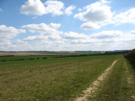
(24) Common Lane |
I followed this path to the edge of Great Chishill where I turned to the left to head between houses back to the B1039 before heading right up the road to St. Swithuns Church, photo 22. According to Wikipedia the highest point of Cambridgeshire, at 146 metres (479 ft) above sea level, is about 800 metres (2,625 ft) east of the church which is where I took photo 23 in a field to the left of the road although once again it was difficult to determine the exact highest point. I continued on down the road before joining a farm track on the right by The Hall. I followed this for a short distance before taking a footpath on the left that ran over fields towards Monkshole Wood where I had another short break, the trees making a perfect shelter from the still cool northerly wind. I then continued ahead over another field to reach building end road where I turned to the left. Where the road ends I then carried on along a byway, Common Lane. At first this was quite enclosed but later, approaching Killem's Green it headed across open fields, photo 24.
 |
 |
 |
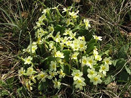
(25) Primroses |
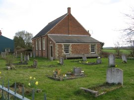
(26) Langley Church |
(27) Chapel, Langley Upper Green |
In places there was a ditch besides the track which had large clumps of primroses growing along its banks, photo 25. Reaching Killem's Green I joined the road for just a few yards before taking another footpath on the left that headed over fields to eventually reach Langley Church, photo 26. From the church it was just a short walk down the road back to my parking space in the centre of the village, passing a small chapel besides the road that can also just be seen in photo 3.
Reaching the car I had walked a total distance of 19.5 miles. It had been a very pleasant days walking and I was pleased I had walked the extra distance towards Melbourn as it has opened up a much better circular walk for the next stage. Despite the longer distance I still had plenty of energy at the end of the day; even after all the walking I have done I can never figure out how sometimes I can walk 19 miles and feel fine and on other days be completely exhausted after just 13 miles.
I have uploaded the route of the walk which can be accessed here Harcamlow Way 6 Route.
If you would like to comment on this walk you can do so here:
![]() Back to:Walk index page
Back to:Walk index page
| ©2012 Bertuchi.co.uk. Please contact me using the email button on the right if you have any questions or comments regarding the site. Any feedback and additional information about places of interest on the walks is always welcomed. All rights reserved. Please contact me if you want to use any of the images or information from the site. ENJOY YOUR WALKING |
|