The Green Chain Walk
Other Links >>> |
|
THE GREEN CHAIN WALK - PART 10
Beckenham Place Park to Crystal Palace Park
|
|
The Green Chain Walk |
I did this walk on Sunday 20th February 2011, following on from stage 9.
 |
 |
 |
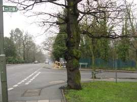
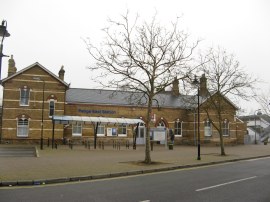
(1) The start of Stage 10 |
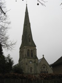
(2) St Pauls Church, Beckenham |
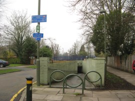
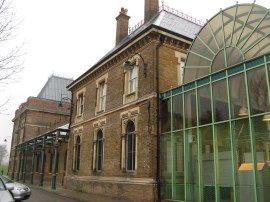
(3) Underpass by New Beckenham Station |
The GPS showed I had walked 9.08 miles when I reached the junction of Southend Road and Stumps Hill Lane, photo 1, which marks the start point of stage 10 of the Green Chain Walk. From here the route heads downhill along the lane to Worsley Bridge Road where the route heads to the left, opposite the grounds of the Kent County Cricket Club. I had been hoping the weather had been going to brighten up during the day but if anything the cloud cover had got thicker and I was now starting to walk through a light but steady drizzle which brought back memories of the very wet day when I had last walked here along the Capital Ring which shares it route with stage 10 of the Green Chain Walk to Crystal Palace. Reaching the end of the road the route heads to the right down Brackley Road, passing the tall stone steeple of St Pauls Church, photo 2. At the end of this road the route turns briefly left along Copers Cope Road before heading to the right down Park Road where the route heads down a damp and rather darkly lit underpass, photo 3, by New Beckenham Station.
 |
 |
 |
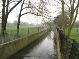
(4) Chaffinch Brook |
(5) Cator Park |
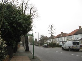
(6) Kent House Road |
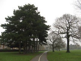
Once under the railway lines the route heads to the left along Kings Hall Road, another of the residential suburban streets that have been a feature of the last few miles of the walk. Reaching a small mini roundabout the route joins a footpath on the right, running at first between houses, which leads out into Cator Park. The path crosses over The Beck and heads past a play area before crossing another small stream, Chaffinch Brook, photo 4. A little further on this joins with the Beck to form the Pool River. Once over Chaffinch Brook the Green Chain Walk bends round to the right along a tarmac path heading through the park, photo 5. At the end of the park the route heads to the left along Lennard Road, passing Cator Park School on the left. Reaching Kent House Road, photo 6, the route heads to the right before joining a fence lined footpath on the left. This is followed between playing fields up to Cator Road where the route heads to the right.
 |
 |
 |
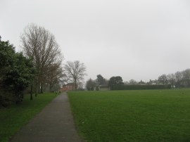
(7) Alexandra Recreation Ground |
(8) Penge East station |
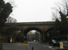
(9) Rail Bridge, Penge High Street |
Leaving Cator Road the Green Chain Walk heads down a rather pot holed driveway on the left that heads down to another area of park, the Alexandra Recreation Ground, photo 7. Here the route heads to the left along a tarmac track running along the lower edge of the parkland and is where I stopped for a short lunch break on a damp bench besides the path. The route then crosses over the middle of the park by the bowling green to join Maitland Road. Leaving Maitland Road the route rejoins Lennard Road, heading to the right before turning left the short distance down Linden Grove to take the footbridge over the railways lines besides Penge East station, photo 8. Here the route heads to the right along Station Road before turning left down Kingswood Road. Reaching the end of Kingswood Road the route turns to the right, heading uphill along Penge High Street, passing under two sets of rail bridges. One a modern bridge by Penge West Station, the other an older and more attractive brick arch across the road, photo 9.
 |
 |
 |
(10) Lower Lake, Crystal Palace Park |
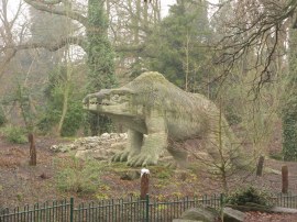
(11) The Megalosaurus, Crystal Palace Park |
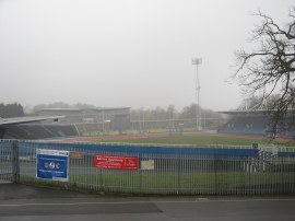
(12) The National Sports Centre |
Crossing Thicket Road the route heads through a black metal gate into the grounds of Crystal Palace Park. Entering the park the route then splits up from the Capital Ring which I had been following since Beckenham Place Park, heading to the left past the side of a café and along the right hand edge of the Lower Lake, photo 10. The route bends its way along an attractive path round the edge of park, passing the iconic dinosaurs, photo 11, which I have vague recollections of being taken to see when very young. Heading away from the dinosaurs, the route bends round to the right, heading steadily uphill passing close by the National Sports Centre, photo 12, as the route heads on to reach Crystal Palace Station.
 |
(13) Crystal Palace Station |
Crystal Palace Station, photo 13, marks the end of stage 10 of the Green Chain Walk, the GPS saying I had now walked 12.7 miles in total, which makes stage 10 a total of 3.62 miles long.
Crystal Palace Station was the point where the Green Chain Walk traditionally had ended however in September 2010 a new section of the walk had been opened. This runs from Crystal Palace Park to Nunhead Cemetery with an arm heading off to Dulwich Park and is where I headed next
I have uploaded the route of the days walk, including stage 10 which can be accessed here Green Chain Walk Sections 9, 10 and 11 Route .
If you would like to comment on this walk you can do so here:
![]() Back to:Main walk index page
Back to:Main walk index page
| ©2012 Bertuchi.co.uk. Please contact me using the email button on the right if you have any questions or comments regarding the site. Any feedback and additional information about places of interest on the walks is always welcomed. All rights reserved. Please contact me if you want to use any of the images or information from the site. ENJOY YOUR WALKING |
|