The Essex Way
Other Links >>> |
|
THE ESSEX WAY - PART 7
Fordstreet to Boxted
|
|
The Essex Way |
I did this walk on 12 April 2009, which was Easter Sunday. I had devised a circular walk for this stage and Fordham, although a short distance away from Fordstreet where I had finished my last walk along the Essex Way, it made a convenient start and finish point for the walk. The roads were very quiet as I made my way out to Essex and I made good time on the journey, arriving not long after 9 o'clock. The only problem was the weather which was very grey and gloomy to start with although fortunately it did brighten up a bit later.
 |
 |
 |
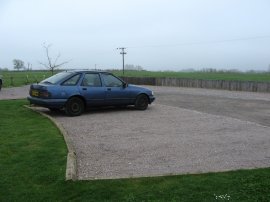
(1) Car Park at Fordham |
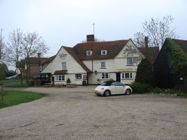
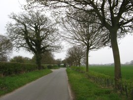
(2) Shoulder of Mutton pub, Fordstreet |
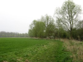
(3) Besides the River Colne, Fordstreet |
I parked my car at Fordham, photo 1, in a car park belonging to the Fordham Hall Estate, before walking the mile and a bit down to Fordstreet and the Shoulder of Mutton pub, photo 2, where I had finished my last walk along the Essex Way. The Fordham Hall Estate covers and area of approximately 200 ha (505 acres) on the northern side of the river Colne and is managed by the Woodland Trust. Further details of this interesting site can be found here: Fordham Hall Estate.
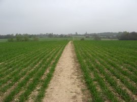
From the pub I then set off along the banks of the River Colne, photo 3, making my way around the field edges to Mill Road.
 |
 |
 |
(4) Path marker |
(5) Marsh land besides the river Colne |
(6) West Bergolt Hall |
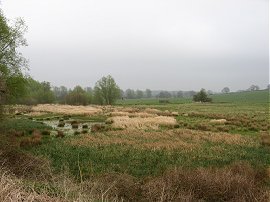
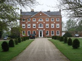
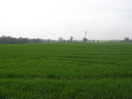
The Fordham Hall Estate is access land and is criss-crossed by a number of permissive paths and I passed a number of brightly painted posts, photo 4, on the way through the estate. The route heads straight across the road, round a small detour past what seemed like the outflow an overflowing cess pit, and along a path running just above the edge of the river which gave good views over the river valley, photo 5. At times the route passed through trees where large numbers of nest bird boxes had been placed. Eventually the route joins a farm track that runs between fields towards a farm house where the route turns to the left, heading briefly along Cooks Hall road, before continuing ahead along a track which starts ascending uphill away from the river. Reaching the top of the hill the route passes the impressive Georgian House of West Bergolt Hall, photo 6.
 |
 |
 |
(7) St Mary's Church, West Bergolt |
(8) Fields nr Horkesley Heath |
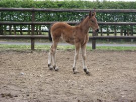
(9) Foal |
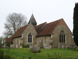
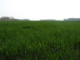
Besides the house is the St Mary's Church, photo 7, which mainly dates from the 14th Century. Opposite the church the Essex Way turns to the right and heads between fields to reach the village of West Bergholt. Leaving the fields the route joins a short stretch of footpath running between housing before reaching the Lexden Road. Here the route heads straight across and then continues down New Church Road. At the end of the road the route turns to the left along Chapel Road, and at the end of Chapel Road joins the B1508 Colchester Road where the route turns to the right. A very short distance down the road the route then turns to the left down Armoury Road, following the road round to the right at the first junction, unlike myself who initially continued straight ahead at this point, although it wasn't long until I realised my mistake. Leaving the urban stretch of walking behind I continued along the road to Armoury Farm where the route turns to the left heading out along a field edge before turning to the left to cross over the middle of a couple of gently sloping open fields, photo 8, as the route starts heading towards Horkesley Heath. At the end of the second field the path bears to the right along a field edge before turning to the left to run alongside the edge of an orchard towards the end of Brick Kiln Road, although the map shows the footpath as taking a more direct route through the orchard. At Brick Kiln Lane the route turns to the right passing between a field and orchard before heading between houses to reach the A134 Nayland Road. The route then heads to the left along the road before turning right down Ivy Lodge Road. The route leaves the houses and soon after crossing a small water course leaves the road and joins a footpath on the left which runs alongside the belt of trees that line the water course on the left and with some paddocks on the right. In one of these paddocks was a small foal, photo 9. Despite the generally dry weather recently this narrow stretch of path was quite damp and muddy in places and was not the most attractive stretch of path to walk along.
 |
 |
 |
(10) Bacon's Lane |
(11) Approaching Carter's Vineyards |
(12) Church Road, Boxted |
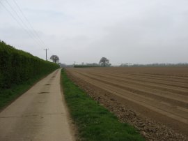
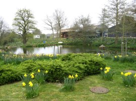
Reaching some houses marked as Spratt's Marsh on the map, the route joins a track, Lincolns Lane, running besides fields which had recently been ploughed into a rows of very deep furrows running between raised areas of soil, photo 10. The route also passes by a couple of large ponds in which there were a couple of large pumps moored in the middle. Reaching the end of a large field the route turns to the right along another farm track, Broad Lane, running between fields. At one point the track passed a large heap of manure which also contained the remains of a crop of onions, many of which had sprouted. Where this track bends to the right the Essex Way continues straight ahead heading through a small patch of wood woodland before passing a small lorry depot and heading on to Boxted Road. Here the route turns left, before turning to the right down Holly Road. Despite a fairly long stretch of walking along the road only one or two cars made there way past me. Just before the end of Holly Road the Essex Way heads down a driveway on the right, passing between houses to join a footpath that runs along the edge of fields where I stopped for a few minutes to eat a sandwich. Reaching the end of the field the route turns left and heads up to Green Lane. Here the I turned to the right for a short distance along the road before turning to the left up the driveway of Carter's Vineyards from where photo 11 was taken. The vineyard is open to visitors and has a small shop although it was not opening for the 2009 season till the following day! Passing the vineyard the route heads up to Church Road, photo 12, where the route turns to the right.
 |
 |
 |
(13) Pond nr Boxted |
(14) St Peter's Church, Boxted |
(15) View towards Nayland |
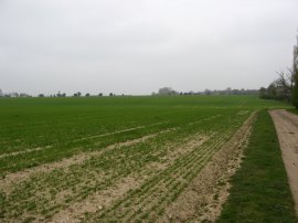
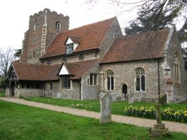
A little further down the road the Essex Way then takes the first left, Burnt Dick Hill. Although it might seem there was a lot of road walking in this section of the walk they were all short lengths along very quiet roads and I was passed by hardly any vehicles at all. The Essex Way then soon takes a footpath on the right that runs along the driveway of some converted farm buildings at Boxted Hall, the path bending round to the right by a large pond, photo 13, to reach the edge of a field. The route then follows the field edge up to another road, opposite St Peter's Church at Boxted, photo 14, where I finished this stage of my walk, having walked another 9.1 miles along the Essex Way. I was also pleased to see there was a small parking area close to the church which will make an ideal start point for my next stage of the walk.
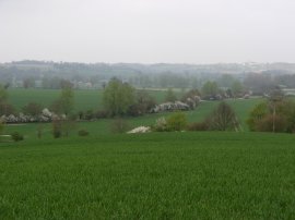
Having stopped and eaten the rest of my lunch in the churchyard I then set off to make my way back to the car. From the church I headed back down to Church Road where I turned to my right heading back towards the way I had come, before continuing ahead into Boxted Church Road. The road was running along the top of a slight ridge and there were good views over the Stour Valley towards the village of Nayland, photo 15, where for a short while a distant church was highlighted by a patch of sunlight.
 |
 |
 |
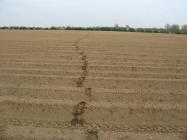
(16) Field approaching Great Horkesley Chuch |
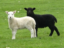
(17) Lambs |
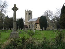
(18) All Saints Church, Great Horkesley |
I left the road along a footpath that leaves the road opposite the junction with Holly Lane. This path heads down over fields, turning to the left to descend down to a field edge before turning left then ascending up the other side, passing between two fishing ponds. Just past the ponds the route headed across a ploughed field to reach the A134. The field had recently been ploughed with quite deep furrows although luckily I was able to step across them quite easily, leaving a trail of footprints across the dry soil, photo 16. I headed straight across the A134, joining another footpath that runs besides a field of sheep and lambs, photo 17, towards All Saints Church, Great Horkesley, photo 18 which stands rather isolated from the village it serves. At the time of doing this walk there is a proposal to build Horkelsey Park, a "Heritage and Conservation centre" in the area and I passed by no end of signs protesting against the proposed development. All Saints church would be surrounded on three sides by the proposed development. it remains to be seen whether planning permission is granted.
 |
 |
 |
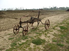
(19) Old Plough |
(20) Heading towards the B1508 |
(21) Approaching Fordham |
For now I was able to join another footpath that runs to the left, bending round the edge of the church before heading out between open fields where I saw an old plough, photo 19, parked on the track between the fields. Approaching an area of trees I joined a footpath on the right that headed downhill towards a couple of ponds before turning to the left near the bottom of the shallow valley to pass through a small section of trees to join Fishponds Hill. Here the route turns to the right heading up the road to reach the village of Little Horkesley. I continued ahead into School Road before taking a footpath on the left that heads down besides a field and continues on between two more fields. Reaching a crossing path I turned to the right and headed alongside the field edge path to Holt's Road. Here I turned to the left, heading down the road. Where the road bends to the left I continued ahead along a footpath that runs up a driveway by a house and along an enclosed path between gardens before once again reaching fields. The route of the footpath headed across a field towards a telegraph pole before turning to the right and heading across the open field, photo 20, to the field edge. The path then bears to the left across a large corner of the next field to head before passing through a hedge and turning to the left along a field side path that runs just above a couple of ponds which are hidden in the trees in the left of photo 20. This path heads up to some houses besides the B1508 Colchester Road where I headed to the right along a newly made footpath that runs along the edge of the field besides the road. The B1508 soon turns to the right however I continued ahead along a similar field side path running alongside Packards Lane before crossing the road and taking a footpath that once again heads out over fields towards a couple of small patches of woodland seen in the distance in photo 21. I headed round the woodland and made my way down to Fordham Road where I turned to the right before soon taking a footpath on the left. This path heads down besides fields to cross over Chappel Road before continuing ahead alongside the edge of Fordham back to my parking place.
All in all this had been another pleasant circular trip and reaching the car I had walked a total of 17.9 miles. My next walk should take me from Boxted on to Manningtree, returning along the start of the St Edmund Way before heading back to Boxted.
If you would like to comment on this walk you can do so here:
![]() Back to:Main Walking index page
Back to:Main Walking index page
| ©2012 Bertuchi.co.uk. Please contact me using the email button on the right if you have any questions or comments regarding the site. Any feedback and additional information about places of interest on the walks is always welcomed. All rights reserved. Please contact me if you want to use any of the images or information from the site. ENJOY YOUR WALKING |
|