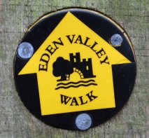
Eden Valley Walk
Other Links >>> |
|
THE EDEN VALLEY WALK - PART 2
Penshurst to Haxted
|
|
Eden Valley Walk |
We did this walk on Sunday 1st February. I drove down to Penshurst where I met up with the rest of the group to continue our walk along the the Eden Valley Walk. I have finally got a new GPS unit, (it was my birthday the day before), and thus I set off with both in my pocket; it was going to be interesting to see how different they make they length of the days walk by the end.
 |
 |
 |
(1) Leaving Penshurst |
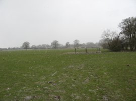
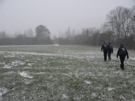
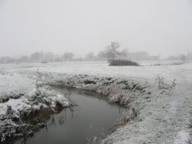
(2) View over the Eden Valley |
(3) The Slips |
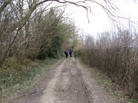
From Penshurst we headed down a driveway towards Salmans Farm, crossing over the River Eden, before taking a track on the right, photo 1, that runs besides fields. Occasionally there were good views to be had from the path across the surrounding countryside, photo 2. The route follows the track for about a mile in total until it reaches a tarmac road by Wat Stock. The Eden Valley Walk then heads along the road to a T junction where the route turns right, heading gently downhill for a short distance before crossing the road and entering a path of woodland known as the Slips, photo 3. (There is also a more direct route to the woodland, cutting diagonally across a field rather than heading up to the T junction and turning right, which is probably a better alternative as it limits the stretch of walking along the road. I'm not sure if we followed the official route or not!). It was another fairly cold day and there was a reasonably strong wind blowing, although there was not the heavy frost of the previous stage.
 |
 |
 |
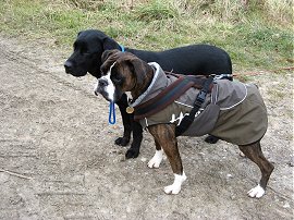
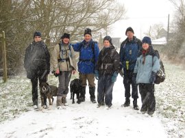
(4) Zuka and Poppy |
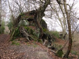
(5) Moor Wood |
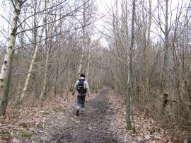
(6) Path through Park Wood |
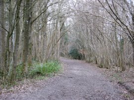
On this walk we were accompanied by Zuka and Poppy, who was sporting a very impressive coat, photo 4. Leaving the trees the path continues over more open ground up to a farmhouse at Hoath Hill. Here the route turns to the left and heads into Moor Wood, photo 5 where the route passes through a stetch of path that cuts through a small outcrop of rock. Either side of the path was lined by tree routes that had grown over the rock. From the woodland the path heads besides a field, across a road and heads alongside another field to join a track that runs round the edge of Park Wood. Part of this path was extremely muddy and we had to detour into the field to avoid the wrost section. The path then passes through the trees for a short distance, photo 6, before joining a track by the grounds of Hever Castle, although the castle itself remained hidden from view.
 |
 |
 |
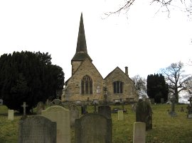
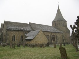
(7) St. Peter's Church, Hever |
(8) View towards Hever Grange |
(9) Hever Station |
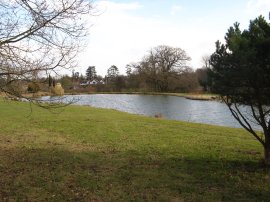
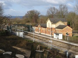
The Eden Valley Walk heads to the left along this track down to join a road by Hever Church, photo 7. Reaching the road the route turns to the left before following the road round to the right past the King Henry VIII inn. The route then continues down the road to a junction where the route turns right before leaving the road and taking a footpath that runs over a field and past the front of a very large house, an idyllic location, apart from having a public footpath so close by. To the left of the path was a large pond, photo 8. The route heads along the driveway to join the Hartfield Road for a short distance. As soon as the road crosses over teh railway lines the route turns ot the right and heads down another driveway past some houses along a path that runs parallel to the railway line. Just before the route reaches Hever station, photo 9, it begins to bear to the left across a couple of large fields.
 |
 |
 |
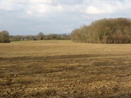
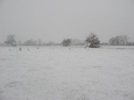
(10) Fields nr Hever |
(11) Fields nr Hever |
(12) Approaching Edenbridge |
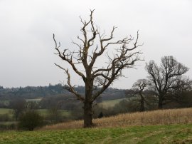
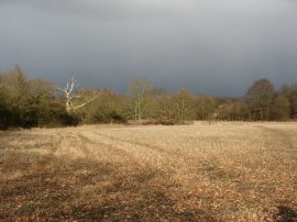
The route heads over the fields towards a pond surrounded by a group of trees, photo 10. The muddy surface of the field had just thawed out enough where the sun had been on it for the soil to start sticking to our boots, although fortunatly this stretch of path did not last for too long. Bearing to the left by the trees the route heads along the field edge, curving round to the right before joining a track by a farm house where we stopped for a while to eat our sandwiches, try our best to find a place sheltered from the wind. Having eaten we set off again, the route passing through the garden of what looked like a barn conversion before heading down to join a road besdies a ruined oast house. At the road we headed to the right for a short distance before taking a footpath off to the left that runs over a field and passes through a tall brick lined arch under the railway. As we were crossing the field the sun put in a brief appearance however ahead heavy dark clouds were building up, photo 11, and there were a few flakes of snow in the air. Once under the railway we followed an indistinct path across a field to join a road where we turned to our right before heading to the left up the driveway to Delaware Farm. Having passed the farm buildings the route bears to the left, crosses over the River Eden and heads out over more open grassy fields. As we were heading over these fields it began snowing, photo 12, the first flurries of snow being accompanied by a very strong swirling wind.
 |
 |
 |
(13) Church of St. Peter and St. Paul, Edenbridge |
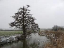
(14) River Eden, nr Edenbridge |
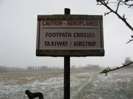
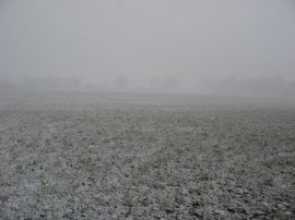
(15) Small airstrip nr Edenbridge |
After heading over a number of fields the route turns to the left and follows a track, crossing over the railway lines once again, to join a road on the outskirts of Edenbridge.The route then heads along a couple of side streets before taking a short stretch of footpath at the end of Churchfield that leads into the churchyard of St. Peter and St. Paul's Church, photo 13. Leaving the churchyard the route heads into Church Street before turning right along the High Street. From the High Street we headed left down Lingfield Road, crossing over a main road and then turning left into Coombe Field. From Coombe field the route leaves the houses to join a path that runs around the edge of a playing field as the route gradually heads round into fields to rejoin the course of the River Eden, photo 14. It had been snowing quite heavily when we passed through Edenbridge and the snow was just beginning to settle on the ground as we made our way along the riverbank. The route leaves the riverbank for a short distance crossing over a patch of open grassland which formed a small airstrip, photo 15, before rejoining the river.
 |
 |
 |
(16) Approaching Cernes Farm |
(17) At the end of the walk |
(18) Path nr Cernes Farm |
A little further on the route turns to the left, crossing over the River Eden and heading out over one final set of fields, photo 16, to reach the official end of the path on the driveway leading to Cernes Farm where the group photo, photo 17, was taken. The Eden Valley walk is another one of the walks that end in the middle of nowhere and it would be interesting to find out why this precise location was chosen to mark the end, or start if walking in the other direction, of the walk. Reaching Cernes Farm we linked up with the route of the Vanguard Way, (which I guess may be the connection with the finish point), and we then followed this path back to where the cars were parked close to Haxted Mill.
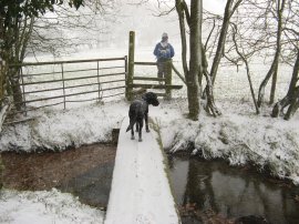
After heading up the driveway we took a footpath off to the left that runs over a couple of fields to join the Starborough Road, on the way crossing a wooden plank over a small stream, photo 18.
 |
 |
 |
(19) Field nr Haxted |
(20) River Eden nr Haxted |
(21) Approaching Haxted Road |
It was still snowing quite heavily, photo 19, and at times there was a very strong wind which isn't always evident from the still photo's. It is however much more apparent in the video below which was taken as we walked along the Starborough Road. Leaving the road the we joined a footpath on the right that headed over a grassy field to join another field where we once again joined up with the River Eden, photo 20. At the end of this field, photo 21, we reached the Haxted Road from where it was just a very short walk to the cars.
Blizzard |
The weather at the end of the walk was very different from the start and it had been very enjoyable to be out walking as the snow started falling. It was the first occasion for a long time I had been out while it was actually snowing. Reaching the car the total distance we had walked for the day was 10.8 miles. (However I forgot to note both how long the actual Eden Valley walk was, (probably about a mile less), or the mileage recorded by my old GPS!).
![]() Back to:Walk index page
Back to:Walk index page
| ©2012 Bertuchi.co.uk. Please contact me using the email button on the right if you have any questions or comments regarding the site. Any feedback and additional information about places of interest on the walks is always welcomed. All rights reserved. Please contact me if you want to use any of the images or information from the site. ENJOY YOUR WALKING |
|