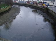
(1) River Lea by the Hertford Union Canal
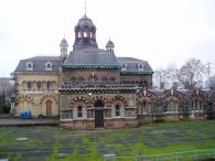
(3) The Big Breakfast House
Other Links >>> |
|
CAPITAL RING STAGE 14
Hackney Wick to Beckton District Park
I walked this, the 14th stage of the Capital Ring on the 27th December 2006. The stage starts besides the River Lea at Hackney Wick then heads along the Greenway towards Beckton District Park.
|
|
|
|
(1) River Lea by the Hertford Union Canal |
(3) The Big Breakfast House |
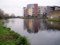
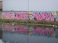
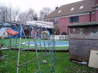
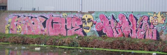
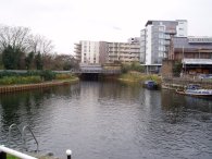
From White Post Lane the Capital Ring continues down the River Lea Navigation, soon passing the junction with the Hertford Union Canal, photo 1. Normally I am not a fan of graffiti, most of which is nothing more than mindless vandalism, but since I had last walked down this section of the canal a number of the walls in the area have been considerably brightened up by some quite decent artwork, photo 2. A short while later the canal passes the Lock Keepers Cottages at Bow which were used as the set for Channel 4 show The Big Breakfast, photo 3. Since the show ended these are now a private house. Just past the house the route passes Old Ford Lock, the only lock the Capital Ring passes along the Lea Valley Navigation.
 |
 |
 |
(4) River Lea |
(5) The Greenway, Bow |
(6) Marshgate Lane |
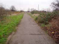
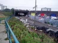
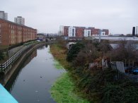
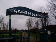
Below Old Ford Lock the River Lea rejoins the River Lea Navigation from the right and the route heads down to join the Greenway which crosses the canal on the grey bridge in the centre of photo 4. This whole area, including the initial stages of the Greenway, photo 5, are very close to the proposed site of the 2012 Olympic Games stadium and associated facilities. It is highly likely that the whole area will look very different in a few years time. The Greenway is a footpath and cycleway that runs along the top of the Northern Outfall Sewer, built in the 1860's, to carry the sewage from North London down to the Thames at a point where it would not flow back up to London on the tides. Not long after joining the Greenway the Capital Ring has to leave it to pass under the main railway lines out of Liverpool Street. After passing the remains of five burnt out motor scooters the route descends a ramp down to Marshgate Lane, photo 6, to cross under the rail lines before immediately taking a narrow path besides a factory back up to the Greenway. The whole area is very run down and dirty with fly tips scattered about the place however the desolation does not last for long.
 |
 |
 |
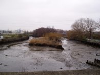
(7) City Mill River |
(8) Waterworks River |
(9) Abbey Mills Pumping Station |
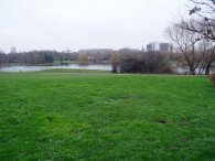
Climbing back up to the Greenway the surroundings gradually improve and the further the route progresses down the Greenway the more the surrounding landscape changes from industrial to urban. Not long after joining the Greenway the route crosses some of the rivers that collectively make up the Bow Back Rivers. Photo 7 shows the City Mill River and photo 8 the Waterworks River. The route once again briefly leaves the Greenway to cross the A11 the once back on the path a little further on the old Abbey Mills Pumping Station is reached, photo 9. It was built in the 1860s by Sir William Joseph Bazalgette, one of the great Victorian civil engineers, to pump an ever increasing amount of sewage away from the city centre. The pumps raised the sewage in the London sewerage system between the two levels of the Northern Outfall Sewer which the Greenway runs over.
 |
 |
 |
(10) Channelsea River |
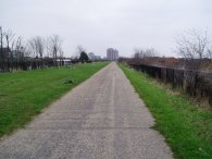
(11) The East Reservoir, Stoke Newington |
(12) The Castle Climbing Centre |
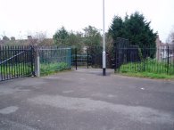
Moving on down the Greenway the route passes over Channelsea River, photo 10, and heads along the Greenway, photo 11, passing West Ham and Plaistow. As it heads towards the Thames the Greenway crosses a number of roads, the junctions marked by metal banners across the path, photo 12.
 |
 |
 |
(13) Exit from the Greenway |
(14) Beckton District Park North |
(15) Fingerpost, Beckton District Park South |
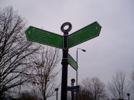
While the Capital Ring has once again been relatively well signposted there was no sign indicating the turn off from the Greenway and I walked past the exit for some distance until I realised I was getting far to close to the A13 and the "Beckton Alp" which was growing ever closer in front of me. Retracing my steps back to the turn off, photo 13, a footpath that runs from the Greenway down between houses down to Stokes Road. The route then turns left into Roman Road and right into Noel Road to take a footbridge over the A13 from where it is just a short walk into Beckton District Park North. The path winds its way around the park, photo 14, crossing Tollgate Road into Beckton District Park South where this stage of the London Loop ends at the signpost in photo 15. The sign showing it was now just 3.5 miles to the Woolwich foot tunnel. In the North part of the park the path was lined by a number of different trees from all around the world which even in Winter were quite interesting to look at. There were also a number of horse drawn buggies "trotting" around the area and surrounding roads although they were all going to fast to get a decent picture.
The GPS made the distance between Hackney Wick and Beckton District Park 5.3 miles. The fingerpost said 5 miles to Hackney Wick which is probably about right allowing for my detour along the Greenway.
![]() Back to:Walking index page
Back to:Walking index page
| ©2012 Bertuchi.co.uk. Please contact me using the email button on the right if you have any questions or comments regarding the site. Any feedback and additional information about places of interest on the walks is always welcomed. All rights reserved. Please contact me if you want to use any of the images or information from the site. ENJOY YOUR WALKING |
|