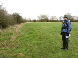
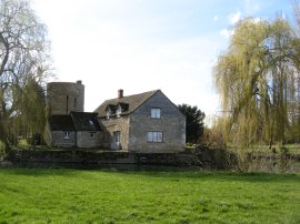
(1) The start of stage 2 nr Cricklade
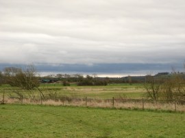
(2) Early morning clouds
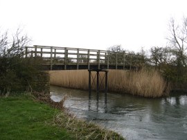
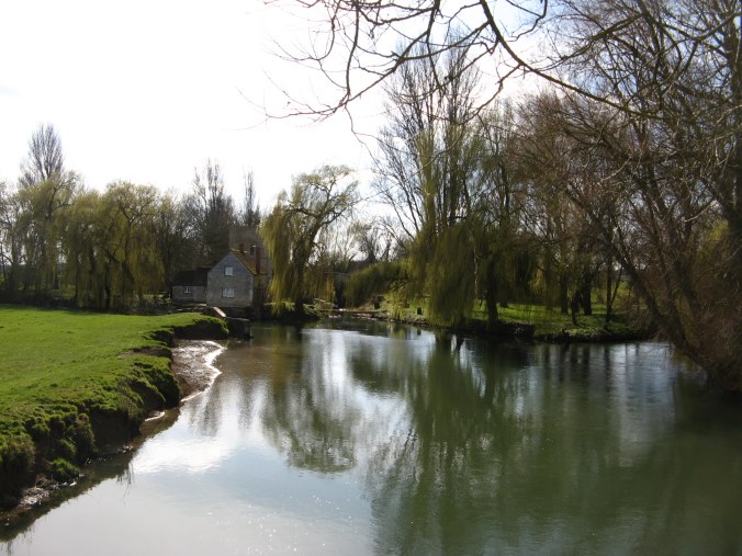
(3) Water Eaton House Bridge
Other Links >>> |
|
THAMES PATH - Part 2
Cricklade to Lechlade
We did this walk on Sunday 16th March. Having both driven over to Lechlade, where we were able to park one of the cars in a lay-by close to St Johns Bridge, we then headed over to Cricklade in Sara's car to resume our walk along the Thames Path from the point just past the A419 road bridge where we had finished the previous stage the day before.
|
|
|
|
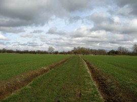
(1) The start of stage 2 nr Cricklade |
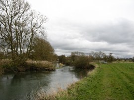
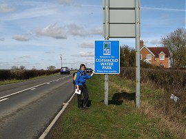
(2) Early morning clouds |
(3) Water Eaton House Bridge |
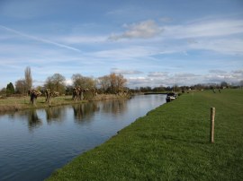
Rejoining the path besides the Thames we began heading downstream with the river to our left and fields to the right. This was a very rural part of the walk with the path following the river as it meanders its way through the surrounding farmland. After a short while the route crossed a wooden footbridge over the river, the path then skirting round the bottom of a low hill below Eysey Manor. It had been raining overnight, and in the early morning, but the rain had stopped before we set off. The weather forecast was for it to brighten up later but as we set of there were still lots of dark clouds around, photo 2, and it felt considerably cooler than the previous day. After heading through a small area of scrubby trees besides a reed lined section of the river the path reaches another footbridge, photo 3, and crosses back to the right hand bank.
 |
 |
 |
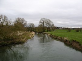
(4) Thames between Cricklade and Castle Eaton |
(5) Thames between Cricklade and Castle Eaton |
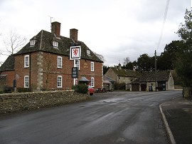
(6) The Red Lion, Castle Eaton |
The path then follows the rivers edge, photo 4 alongside a number of fields and meadows, photo 5, as it makes its way towards the village of Castle Eaton, occasionally crossing over small footbridges over tributaries and ditches running into the Thames from the surrounding farmland. Approaching Castle Eaton the path heads away from the river before heading up a track between houses to join a road known as The Street running through the village. Even at this early stage the weather was starting to brighten up a little and we stopped at a bench outside the Red Lion pub, photo 6, where I was able to remove one of the two fleeces I was wearing.
 |
 |
 |
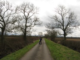
(7) Blackford Lane |
(8) Little Crouch Hill |
(9) Thames Path nr Upper Inglesham |
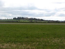
The path follows The Street through the village, heading to the right by the barns of Manor Farm before heading to the left along Church View. This road is followed round to the right before the route of the Thames Path then heads to the left along Blackford Lane, photo 7. This dead end road heads past a couple of properties and is then followed over fields, the Thames Path now running some distance away from the river itself. Away to our left we could see the tall tower of the church in the village of Kempsford on the other side of the river. Eventually, after heading around a couple of bends, the track reaches an isolated farmhouse where the tarmac ends and the route joins a farm track that soon bends to the left along a field edge to rejoin the riverbank. However after heading across just one field besides the river the Thames heads off to the left and the path continues ahead running alongside a smaller sub channel of the river. This is followed up to a road, close to Hannington Bridge where the route heads to the right. After the following the road for a short distance the route joins a driveway on the left which runs past a particularly fine house before once again heading out along a footpath running between fields and the occasional area of small trees. Away to the right we could see Little Crouch Hill, photo 8, rising above the surrounding farmland. Just like the previous day we were making very good time along the path as we headed through the farmland running one or two fields above the course of the river. Away to the right were a number of buzzards, some soaring on the thermals, other perched on the top of a tall tree, all making their distinctive call almost sounding like the meow of a cat. Shortly after having headed across the middle of a large field, photo 9, the paths turns to the right and heads gently uphill along a field edge path that leads into the village of Upper Inglesham.
 |
 |
 |
(10) Sara besides the A361 |
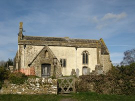
(11) St John the Baptist Church, Inglesham |
(12) Thames nr Inglesham |
Just before we reached the village we stopped for a short break and the sun was now warm enough, just, for me to take off my fleece. Reaching a minor road the route heads up to the left to join the busy A361 Lechlade Road. I had not been looking forward to this stretch of the walk as the Thames Path now has to head to the left along the busy A road for just over a mile, photo 10. The pavement soon ends and we crossed over to the other side of the road to walk along the grass verge, facing the oncoming traffic. Fortunately the verge was reasonably broad for most of its length and the surface quite even to walk along and we soon found ourselves opposite the turning down to Inglesham where we were able to leave the noisy road. A short distance down this road the Thames Path joins a footpath on the right however we continued ahead a short distance down the road to visit the church of St John the Baptist, photo 11, where we stopped for our lunch break on a bench in the churchyard of the small picturesque church. It was a lovely peaceful and sheltered location and I could have happily dozed off in the now warm sunshine. However we had the remainder of the stage to walk so having eaten we retraced our steps the short distance up the minor road to join the footpath that leads back to the banks of the river. This footpath heads across a couple of grassy meadows to rejoin the river bank, photo 12.
 |
 |
 |
(14) Canal Roundhouse |
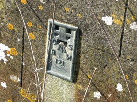
(15) Flush Bracket 121 |
Once back besides the river it was only a very short walk further before we came to the point where the River Coln joins the Thames and where the now long disused Thames - Severn canal set off from the river; the river to right of photo 13 and the canal just to the right of the house in the centre of the photo. Just visible be the house, photo 14, is one of the unusual road lockkeepers houses that were built at various locations along the Thames Severn canal. Opposite the lock keepers house was the concrete remains of a pier that had once supported the footbridge over the canal and attached to the side of this was an Ordnance Survey trig point bracket, 121, photo 15. This flush bracket was used during the Second geodetic levelling, England & Wales, undertaken between 1912 and 1921. This was levelled with a height of 238.4750 feet above mean sea level which gives some indication of the leisurely pace of descent of the river towards the point where it becomes tidal by Teddington Lock. The surveyor's description was "Flush Bracket on concrete foundation of footbridge, at Round House, Inglesham".
 |
 |
 |
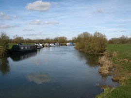
(16) Boats on the Thames nr Lechlade |
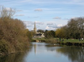
(17) Approaching Lechlade |
(18) Halfpenny Bridge, Lechlade |
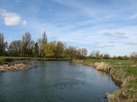
With the waters of the Coln now added to those of the Thames the river becomes deep enough to be navigated by small craft and a short distance further down the field edge path we saw the first boats moored up against the river bank, photo 16. Ahead of us we could see the tall stone spire of St Lawrence Church in Lechlade rising above the river and besides us the bank was lined by anglers enjoying a Sunday afternoons fishing, photo 17. Heading into Lechlade the path passes a small marina and soon we reached the Halfpenny Bridge, photo 18. This bridge was built in 1782 from the local Cotswold Stone and the name refers to the toll that was once charged to cross over it.
 |
 |
 |
(19) A duck on river |
(20) Heading towards St John's Lock |
(21) St John's Lock |
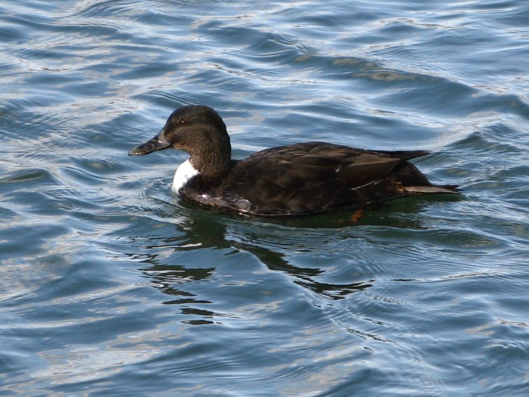
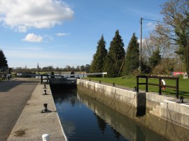
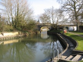
The were quite a few different types of ducks by the bridge including the one in photo 19 although I am not sure what type it is, any thoughts? From the Halfpenny Bridge the Thames Path follows the river across a number of open grassy fields, photo 20, towards St John's Lock, photo 21. St John's Lock is the first lock of the 45 locks encountered on the Thames and was originally built in 1790.
 |
 |
 |
(22) Old Father Thames |
(23) St John's Bridge |
(24) Myself and Sara by St John's Lock |
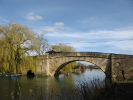
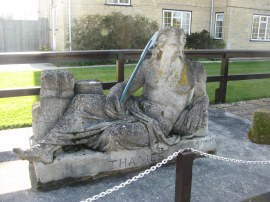
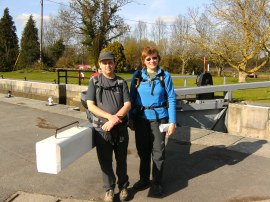
Situated besides the lock is the statue of Old Father Thames, photo 22. This was commissioned in 1854 for The Crystal Palace's grounds and was later moved to the traditional source of the Thames at Thames Head before being relocated to the lock. A few yards past the lock is St John's Bridge, photo 23, which marked the end of this stage of our walk along the Thames Path, photo 24.
From the bridge it was then only a short walk up the road past the Trout Inn to our parking place. Reaching the car we had walked a total distance of 11.5 miles of which 11.3 were along the path. Despite the stretch along the A361 this had been another good days walk and again we had made good progress along the path. I definitely think that due to the easy nature of the path that for our next walks we can plan on doing slightly longer stages than I had originally considered.
As usual I have uploaded the route of the walk which can be accessed here: Thames Path Stage 2 Route.
If you would like to comment on this walk you can do so here:
![]() Back to:Main index page
Back to:Main index page
| ©2012 Bertuchi.co.uk. Please contact me using the email button on the right if you have any questions or comments regarding the site. Any feedback and additional information about places of interest on the walks is always welcomed. All rights reserved. Please contact me if you want to use any of the images or information from the site. ENJOY YOUR WALKING |
|